

Mars Renderings
| Published: | 09.10.2025 |
NASA
USGS Astrogeology Science Center
Settings
All images were simulated without atmosphere so that the height differences are better shown and do not appear blurry. The altitude profile is estimated to be exaggerated by a factor of 2, in reality Mars is a bit flatter than shown.
The tilt of the planet has been set to a realistic 25 degrees, so Mars rotates from the bottom left to the top right in the video.
Global views
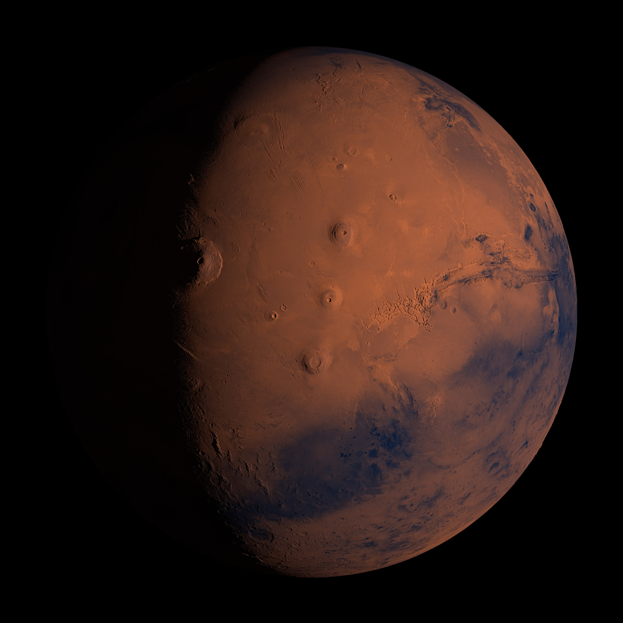
Olympus Mons on the left and Valles Marineris on the right.
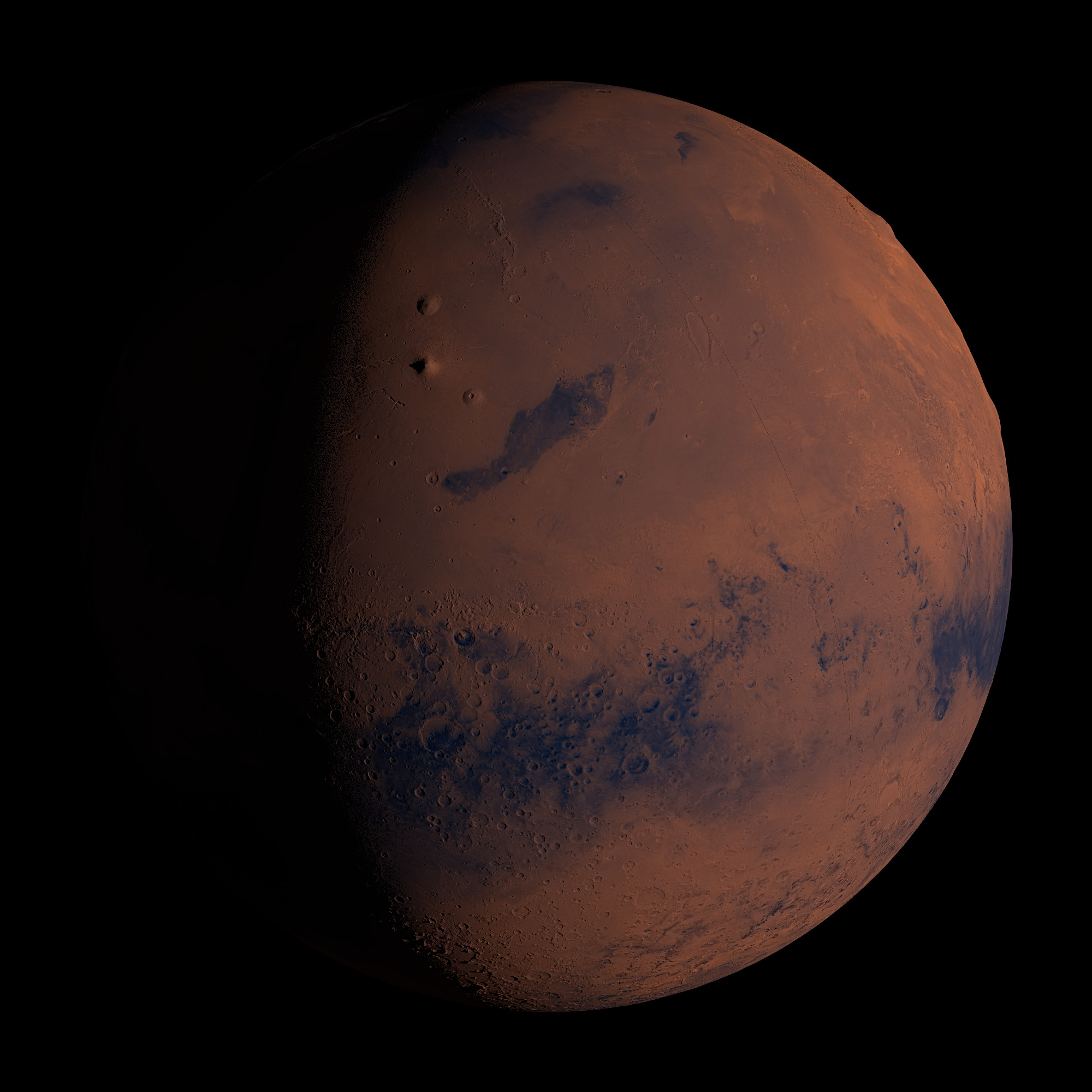
In the middle of the picture the three large volcanoes of the Tharsis Montes area.
From bottom to top: Arsia Mons, Pavonis Mons, Ascraeus Mons.
In the middle of the picture the three large volcanoes of the Tharsis Montes area.
From bottom to top: Arsia Mons, Pavonis Mons, Ascraeus Mons.
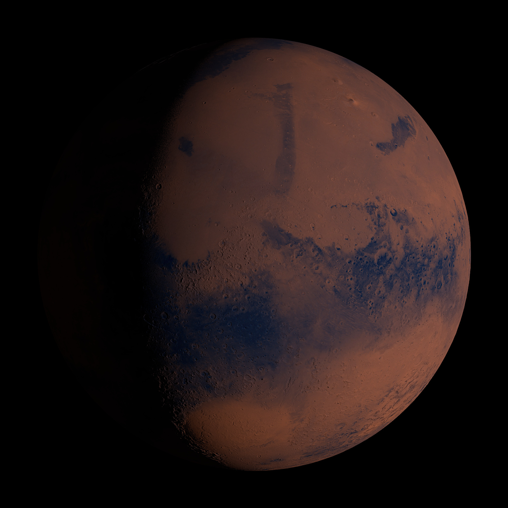
A quarter of a rotation further on, the next mountains appear:
The very pointy one is Elysium Mons, 12 kilometers high.
Above it lies Hecates Tholus and the small one below it is Albor Tholus.
At the top right, Olympus Mons makes the planet a bit un-round.
If you look closely, you will discover Gale-Crater to the left of the center of the image (see below).
The very pointy one is Elysium Mons, 12 kilometers high.
Above it lies Hecates Tholus and the small one below it is Albor Tholus.
At the top right, Olympus Mons makes the planet a bit un-round.
If you look closely, you will discover Gale-Crater to the left of the center of the image (see below).
The large, bright, elliptical area at the bottom is Hellas Planitia.
At 9 kilometers below the average altitude, it is the lowest point on Mars.
At 9 kilometers below the average altitude, it is the lowest point on Mars.
Cutouts / Craters
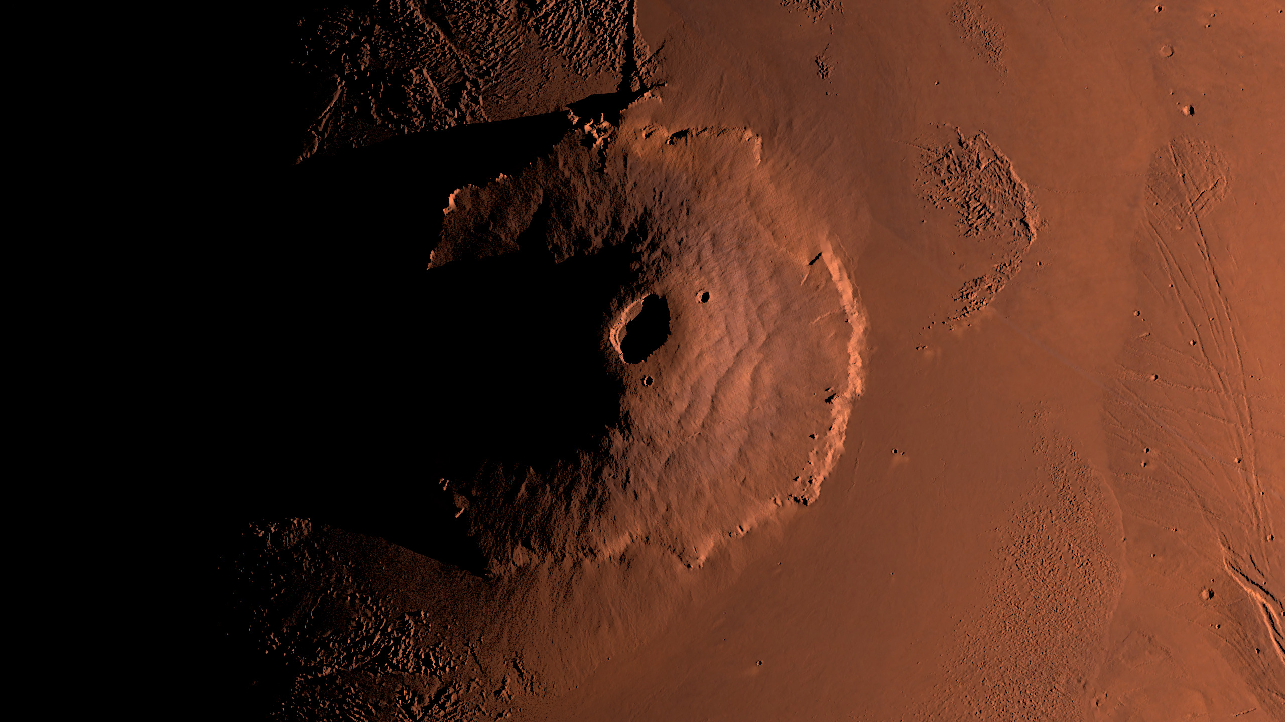
Olympus Mons
The highest volcano in the entire solar system in its full glory.
Its highest point is at an altitude of 26 kilometers, relative to the lowlands surrounding it.
With a diameter of over 600 kilometers, it has about the same dimensions as France.
The highest volcano in the entire solar system in its full glory.
Its highest point is at an altitude of 26 kilometers, relative to the lowlands surrounding it.
With a diameter of over 600 kilometers, it has about the same dimensions as France.
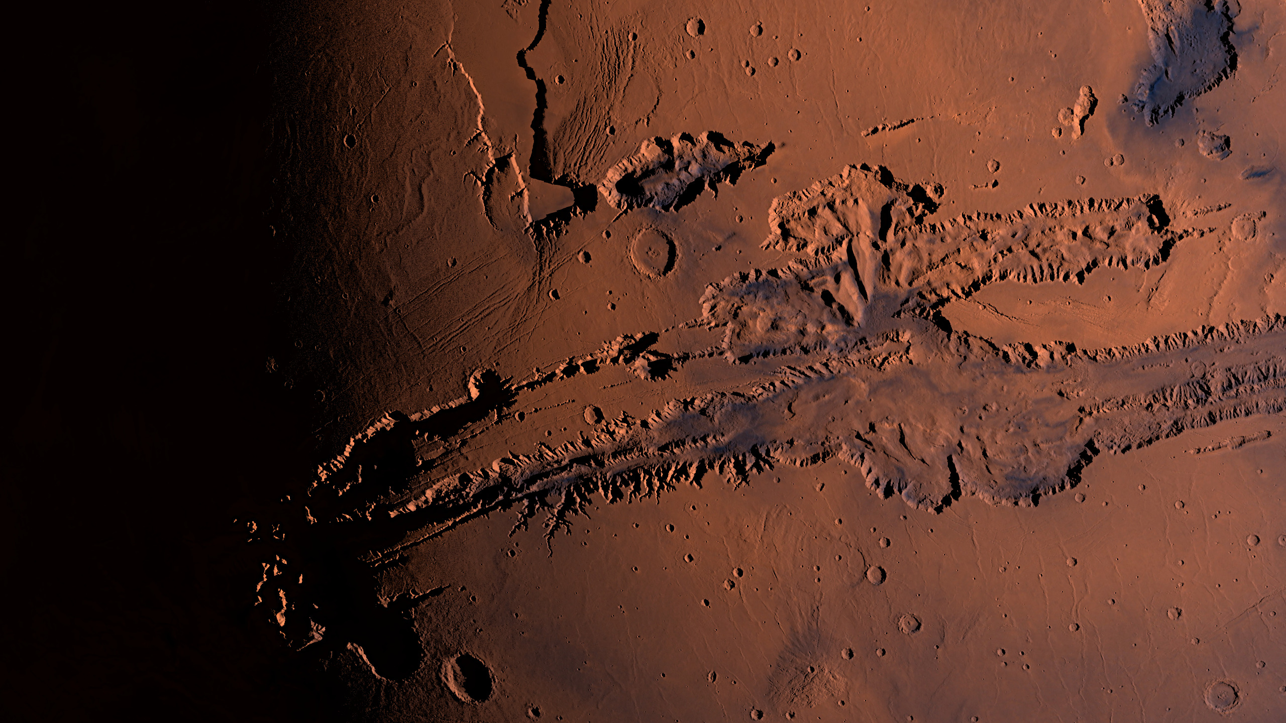
The Valles Marineris is an impressive 4,000 kilometers long from left to right, the size of Australia, of which only the western 2,500 kilometers can be seen here.
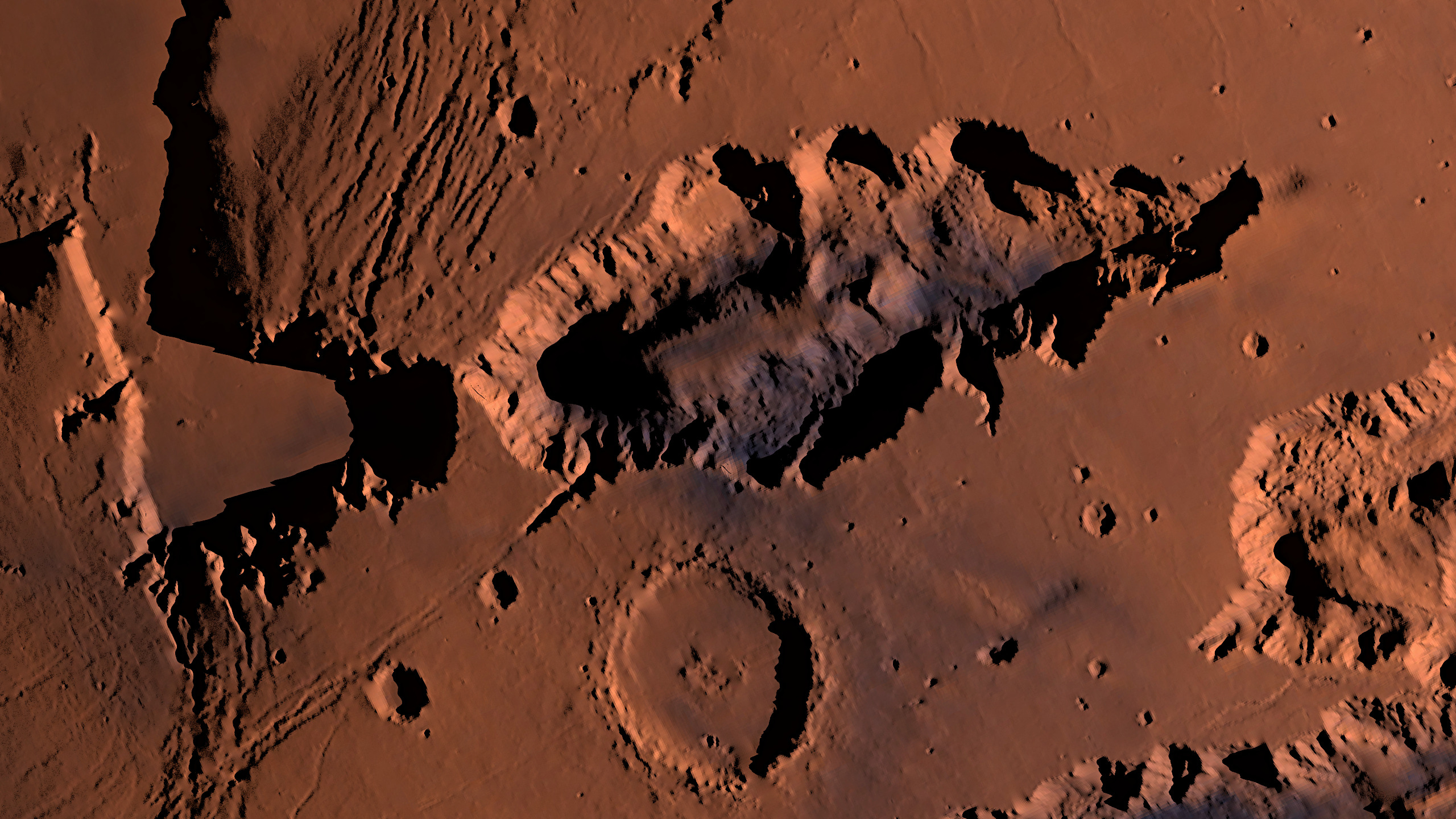
Hebes Chasma
One of my favorite canyons, 320 kilometers wide and 6 kilometers deep. Just below it crater Perrotin, more below Valles Marineris, in the west you stumble over Olympus Mons after a few thousand kilometers.
The chosen magnification is already too much for my raw data, in the high-resolution version of the image distortions and "color blocks" can be seen right away.
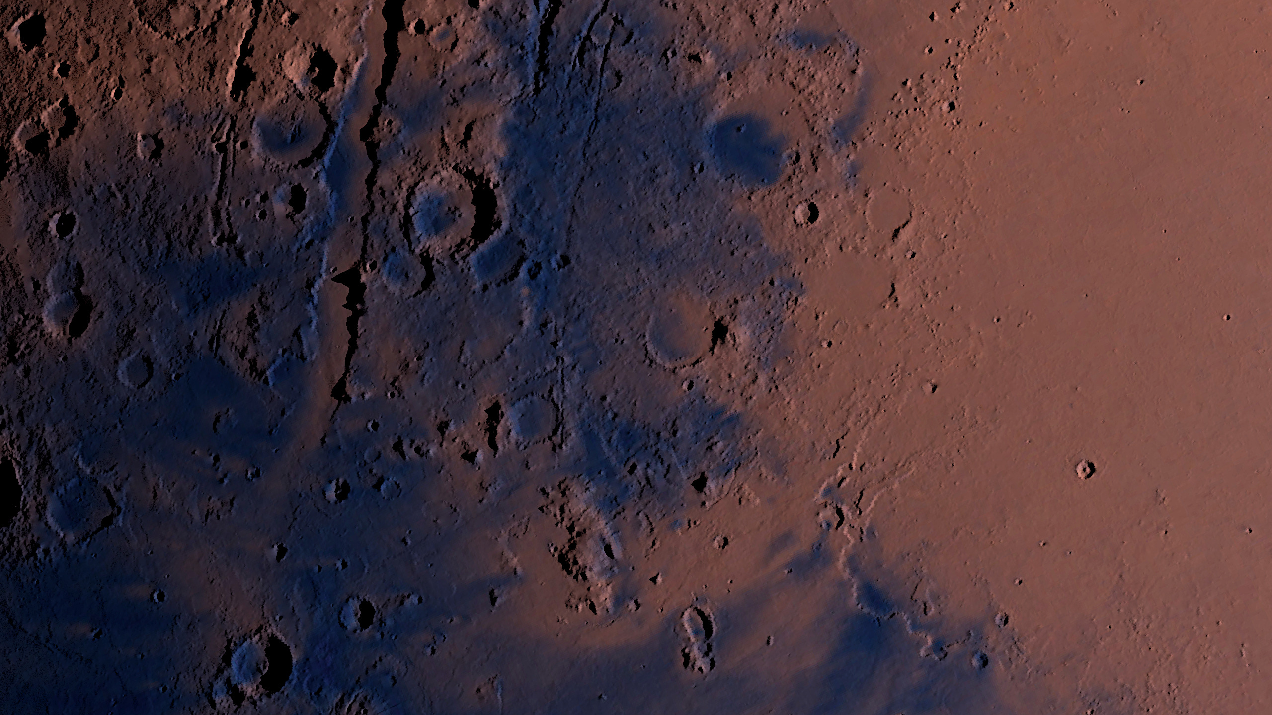
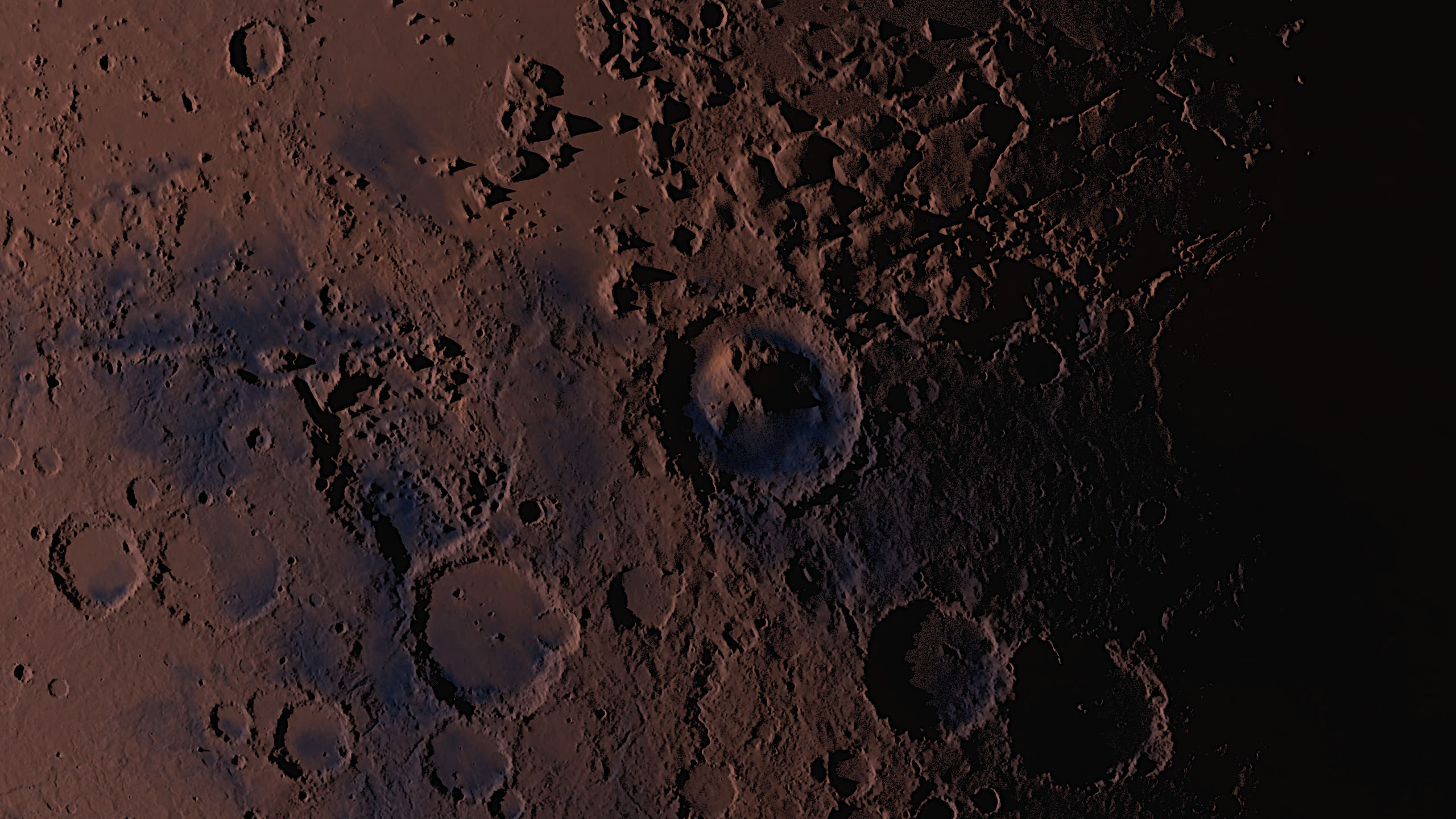
Jezero-Crater
The 45-kilometer Jezero crater in the center of the image is easily recognizable by its flat interior and the high mountain on the right flank. On February 18, 2021, NASA rover Perseverance landed in it, whose route of 37 kilometers (as of October 2025) can be tracked on a map. On board was his flying colleague Ingenuity, who has already completed his last flight.
The 45-kilometer Jezero crater in the center of the image is easily recognizable by its flat interior and the high mountain on the right flank. On February 18, 2021, NASA rover Perseverance landed in it, whose route of 37 kilometers (as of October 2025) can be tracked on a map. On board was his flying colleague Ingenuity, who has already completed his last flight.
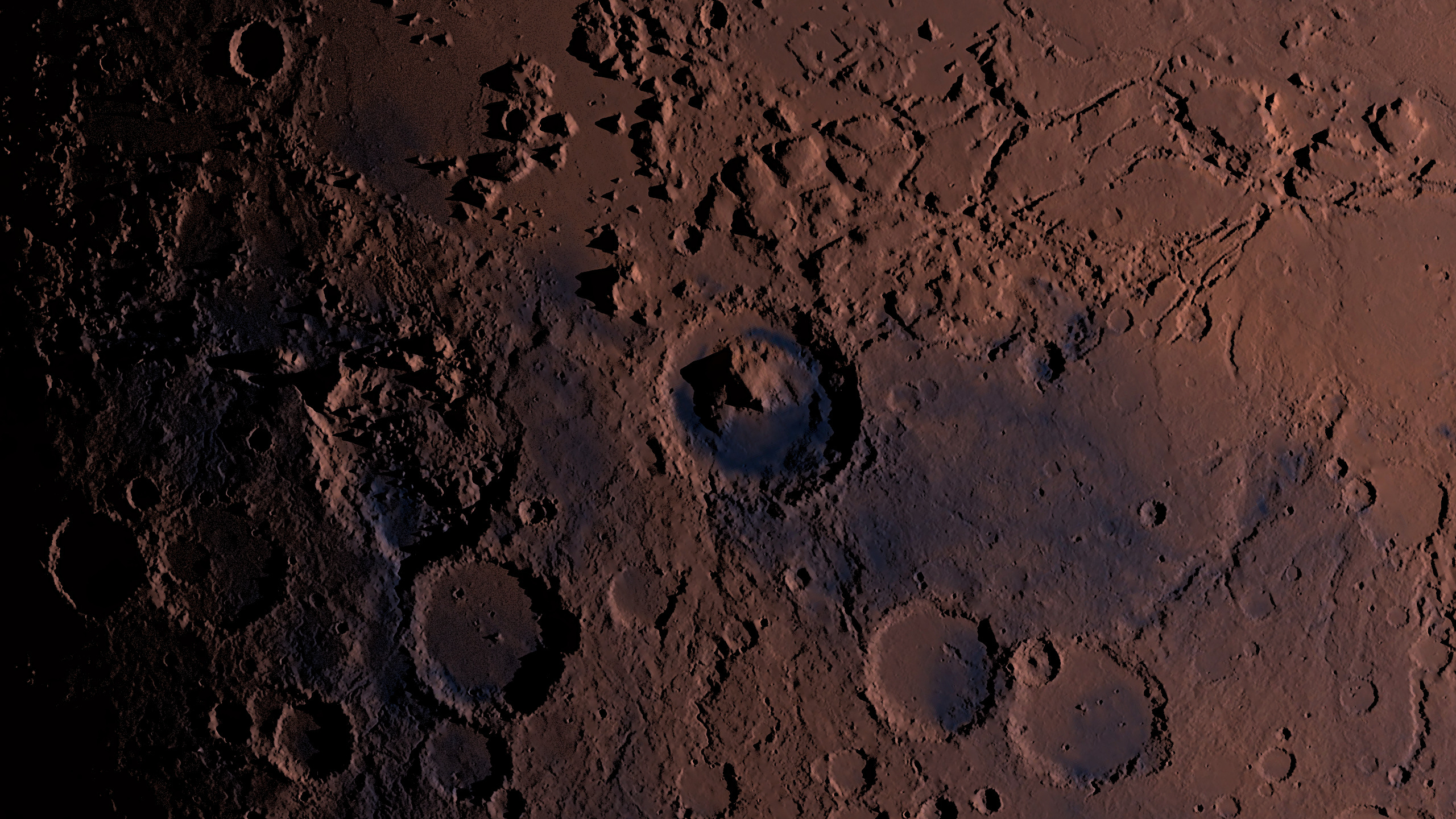
Gale-Crater at dawn
Gale-Crater at dusk
The two images above show the home of NASA's Curiosity rover, which landed in the upper left corner of the 150-kilometer-wide crater back in 2012. Since its arrival, the rover has driven 36 kilometers (as of October 2025), its route can also be viewed.
The two images above show the home of NASA's Curiosity rover, which landed in the upper left corner of the 150-kilometer-wide crater back in 2012. Since its arrival, the rover has driven 36 kilometers (as of October 2025), its route can also be viewed.
Videos
The video can also be found on my Youtube channel, which can be liked and subscribed.Double-clicking on the video switches to fullscreen mode (recommended).
Mars - global View
49 seconds - 1200x1200px - 21 MB
1480 frames - 30 fps - 21 crf - lib264 A Mars day is about 24 hours and 40 minutes long.
Let's calculate: 24.66 * 60 minutes = (almost) exactly 1480. The video consists of 1480 individual frames (frames), so each frame in the video is equivalent to one minute on Mars, and at 30 frames per second (fps) each second in the video shows half an hour on Mars.
Any questions?